MONT DE L'ETOILE (VS)
Active rock glacier
Elevation: 2950-3050m - Massif: Valais Alps (Aiguilles Rouges) - Commune: Evolène (VS)
The eastern slopes of Mont de l’Etoile are subject to frequent terrain instabilities (rock falls, landslides, mud flows, etc.). Satellite interferometry data showed, that a rock glacier, perched in the higher parts of this slope, already moved at several meters per year around 1995. GNSS measurements, which have been performed between 2013 and 2018, have indicated velocities of 5-7 m/year, decreasing since over time. As an effect of the significant movements of the rock glacier, the talus slope on which it rests and which it feeds, sags at around 3-5 cm/year. This process was already observed in the 1990s via satellite radar interferometry.
-
Measurements and observations
Thermal (ground surface temperature : GST)
Geodetic (GNSS) -
Figures
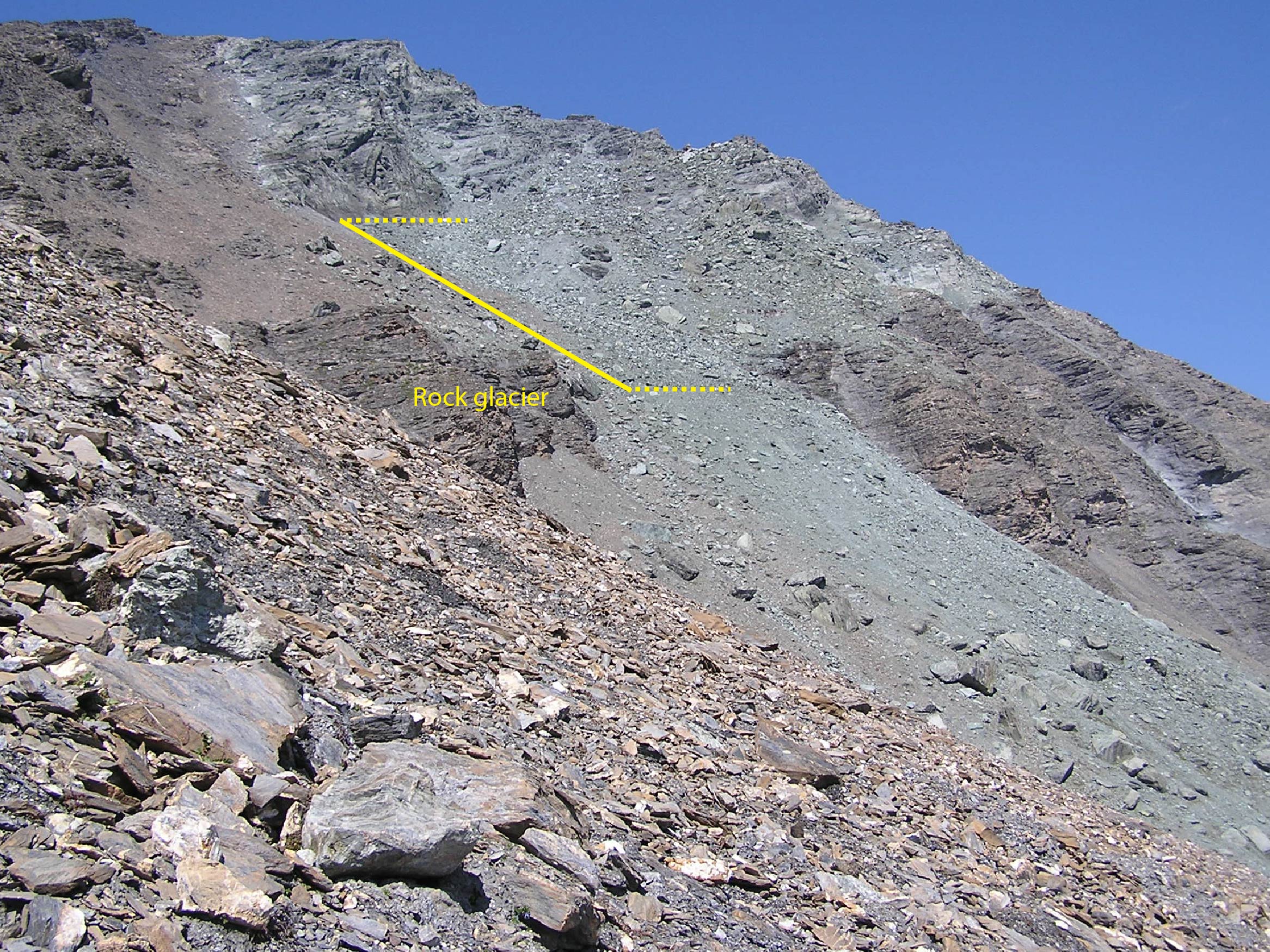
The very active rock glacier on the eastern slope of Mont de l’Etoile (photo: August 2005).
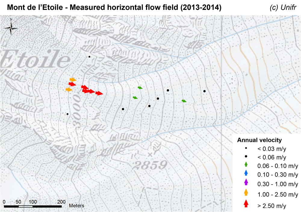
Measured horizontal flow field (mean annual velocity).
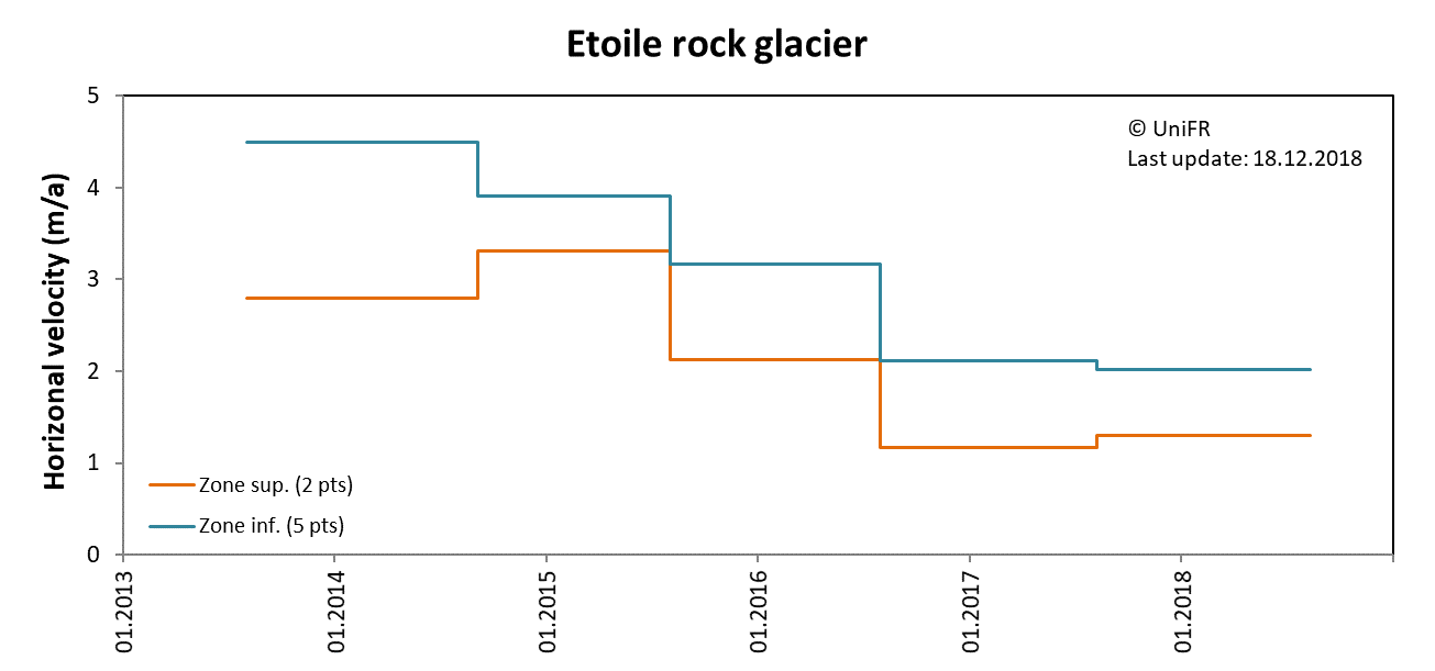
Annual horizontal surface velocity in several sections of the rock glacier. Mean of selected sets of points in the upper (Zone sup.) and lower (Zone inf.) sections of the rock glacier.
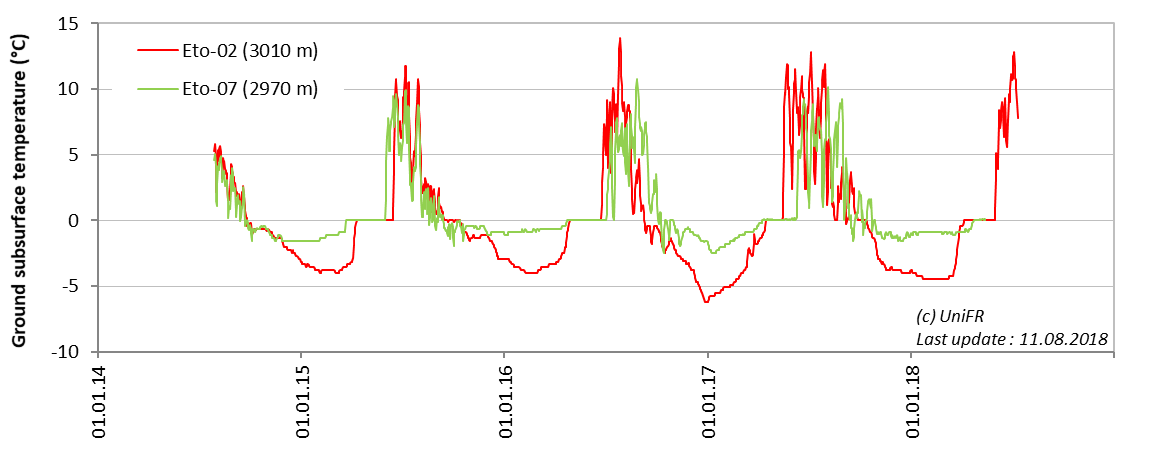
Daily ground surface temperature (GST) at two locations on the rock glacier.
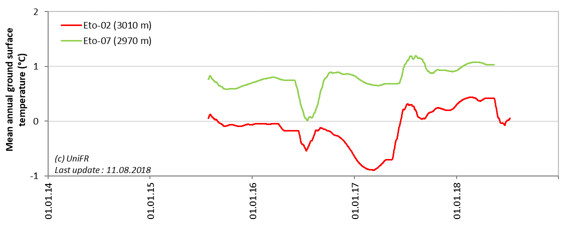
Mean annual ground surface temperature (MAGST) at two locations on the rock glacier.
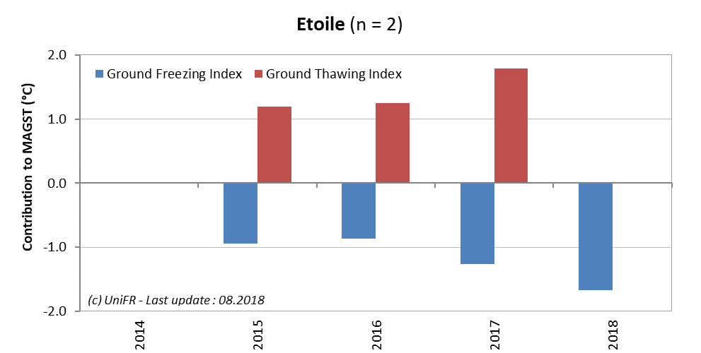
Contribution of the annual Ground Freezing (sum of all daily mean values < 0°C) and Ground Thawing (>0°C) Indexes to the mean annual ground surface temperature (MAGST) on a set of selected locations (n) on the site with indication of the respective trend since the beginning of the time series. Or : how cold was the winter and how warm was the summer at the surface of the ground ?
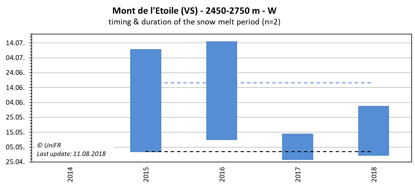
Annual dates of the start and end of the snowmelt period (zero curtain phase). Mean of n sensors placed on permafrost terrain. The dotted lines show the mean dates since the beginning of the time series.
-
Collaboration
-
Publications
Delaloye, R., Strozzi, T., Lambiel, C., Perruchoud, E., Raetzo, H. (2008). Landslide-like development of rockglaciers detected with ERS-1/2 SAR interferometry. Proceedings of the FRINGE 2007 Workshop, Frascati, Italy, 26-30 November 2007 (ESA SP-649, February 2008) (pdf)